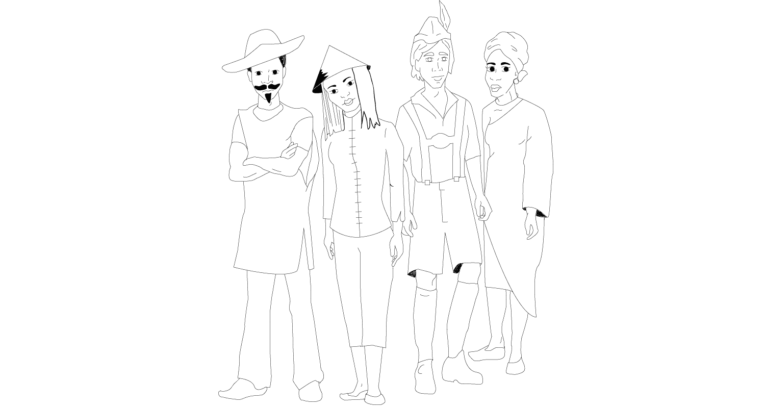
Taiwan
photos by Leslie Biggar
- 23°30’ N | 121°00’ E | PST+16
- Elevation
- 0 metres (South China Sea) to 3952 metres (Yu Shan)
- Population
- 23 million (July 2007 est.)
- Major cities
- Taipei (capital), Hsinchu, Hualien & Kaohsiung
- Languages
- Mandarin (official), Min Nan Chinese (aka Taiwanese) & Hakka dialects
- Currency
- New Taiwan Dollar (TWD). $1 CAD = $30.97 TWD
- Embassy in Vancouver
- www.taiwan-vancouver.org
- Airlines
- EVA Air & China Airlines fly direct to Taiwan from Vancouver.
- Distance from airport to city centre
- Taiwan Taoyuan International Airport (TPE) is 40km from Taipei. Kaohsiung International Airport (KHH) is 9 km from Kaohsiung.
- Transportation
- Taiwan has developed an extensive infrastructure & numerous means transportation. Means of transportation include air, rail, water & road transit.
- Climate
- Taiwan has a subtropical climate: hot summers & mild winter. During the winter, the southern part of island is sunny, while the north is cool & rainy. From May to September, it’s humid & rainy. The typhoon season lasts from July to October.
- Chiang Ku | September
- The 7th month of the lunar calendar is celebrated as Ghost Month in Taiwan. The Taiwanese believe ghosts wander the earth unhappily during this month. As such, the living make offerings to appease them. In a competition called Chiang Ku, offerings to the hungry ghosts are placed on top of a tower 4 stories high made of 4 poles. A priest performs a rite, & with the wandering ghosts fed, the living are safe for another 3 years. The public then is challenged to form teams & attempt to scale the poles, grab a series of flags & the offerings. No easy task—the poles are smeared with beef fat! Each team has 5 members who form human pyramids & use ropes to haul themselves over the platform’s lip. They slip, slide & scramble their way to the top, throw the offerings to the cheering crowd below & collect the final flag, which marks the end of the ceremony. Chiang Ku demands strength, skill, courage, team spirit & a measure of recklessness. In past years, people attempting the climb were hurt, & even killed, which led to its banning; only in 1991 was it revived, with new safety regulations.
Vietnam
photos by Vanessa Marshall
- 16°00’ N | 106°00’ E| PST+15
- Elevation
- 0 metres (South China Sea) to 3143 metres (Fansipan)
- Population
- 85 million (July 2007 est.)
- Major cities
- Hanoi (capital) & Ho Chi Minh City (Saigon)
- Languages
- Vietnamese (official), English, French, Chinese (Cantonese/Mandarin), Khmer & Russian
- Currency
- Dong (VND). $1 CDN = 15,912 VND
- Embassy in Ottawa
- www.vietnamembassy-canada.ca
- Airlines
- En route flights stop in Hong Kong, South Korea or Taiwan. Airlines picks: Air Canada, Cathay Pacific, EVA Air, China Airlines & multiple American carriers.
- Distance from airport to city centre
- Tan Son Nhat International Airport (Saigon) (SGN) is 8 km from Ho Chi Minh City. Noi Bai International Airport (Hanoi) (HAN) is 45 km from Hanoi.
- Transportation
- The highway system is extensive; rural roads often need repair. Train travel is affordable & routes run the length of Vietnam’s coast. Bus travel is the preferred means of travel. Car travel is the best & safest way to see Vietnam. (Note: international drivers licenses are not recognized.)
- Climate
- Vietnam has a subtropical monsoon climate: cool at higher elevations & hot & humid in the south. The weather is determined by two monsoons: the winter monsoon from the northeast brings wet chilly winters (October to March); the southwestern monsoon (April/May to October) brings warm, humid weather & rain—except in the mountains.
- Bay Nui Festival | March
- The Khmer people of Vietnam, a minority group from the Mekong Delta province of An Giang, ring in the New Year with the Bay Nui (Cow Race) Festival. Locals pay tribute to their ancestors by inviting their souls to dine with them in a pagoda. After food & prayer, attendees walk to a local river where offerings are placed on rafts made of banana tree trunks, pushed into the water & swept away by the current. These tranquil proceedings are followed the highlight of the festival—the cow races! The 60 metre-wide & 70 metre-long racing strip is a muddy & slippery field in a basin. Spectators sit high on the banks with food to eat & pots & pans to bang. The start & finish lines are marked with red & green flags. Each race pits two pairs of cows against one another, while a local man controls each team. (Cow teams must more or less run in a straight line or face disqualification.) First one to the end wins! In 2007, 70 cow teams participated.
Japan
photos by John R. Burgreen III
- 36°00’ N, 138°00’ E | PST+16
- Elevation
- -4 metres (Hachiro-gata) to 3776 metres (Mount Fuji)
- Population
- 127 million (July 2007 est.)
- Major cities
- Tokyo (capital), Yokohama, Osaka & Nagoya
- Languages
- Japanese (official), Ainu & Korean
- Currency
- Yen (JPY). $1 CAD = ¥98 (JPY)
- Embassy in Vancouver
- www.vancouver.ca.emb-japan.go.jp
- Airlines
- Air Canada is the only Canadian airline that flies to Japan. US carriers that fly to Japan include American Airlines (AA), Delta Air Lines (DL), Northwest Airlines (NW) & United Airlines (UA).
- Distance from airport to city centre
- Narita International Airport (NRT) is 66km from Tokyo. Kansai International Airport (KIX) (aka Chubu Airport) is 60km from Osaka. Central Japan International Airport (NGO) is 35km from Nagoya City.
- Transportation
- Trains, including the famous bullet train, crisscross Japan. With the use of a Japan Rail (JR) pass, tourists have unlimited use of JR trains. Subways are in major cities; bus service is available in towns & cities across Japan.
- Climate
- Japan has four distinct seasons. Northern Japan is fairly cold in the winter, while the Pacific coast stays relatively mild. At the southern tip of Japan, Okinawa has a subtropical climate.
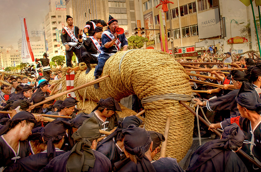
- Great Tug-O-War | October
- Naha, the capital of Okinawa, Japan, plays host to the Annual Naha Festival, an event that primarily revolves around The Naha Great Tug-of-War. On the day of the tug, 250,000 people show up to watch the contest, in which East & West Naha residents fuel a longstanding friendly rivalry, by tugging on a rope over 200 metres in length, weighing 43 tons! The prize: bragging rights & good luck for the coming year. It is truly a community endeavour— as many as 50,000 Naha residents help pull the rope. Two locals dressed in costume represent the Kings of East & West Naha. They stand on platforms erected on top of the rope, a few feet from the centre. Clad in traditional garb & flanked by guards dressed as panda bears, they taunt one another. Fourteen teams in traditional Okinawa costumes, representing each of Naha’s traditional tribal communities, cheer on the pullers. The rope, which is constructed every year, costs $170,000 in materials & takes 16 volunteers a full six weeks to complete.
China
photos by Brent Richter
- 35°00’ N, 105°00’ E | PST+15
- Elevation
- -154 metres (Turpan Pendi) to 7756 metres (Gongga Mountain)
- Population
- 1.32 billion (July 2007 est.)
- Major cities
- Beijing (capital), Hong Kong, Shanghai & Guangzhou (Canton)
- Languages
- Mandarin (official), English & Portuguese
- Currency
- Yuan (or Renminbi) (CNY). $1 CAD = 7.1 CNY
- Embassy in Vancouver
- www.vancouver.china-consulate.org
- Airlines
- Multiple carriers offer daily non-stop flights from Vancouver to Beijing, Shanghai-Pudong, Shanghai-Hongqiao & Guangzhou.
- Distance from airport to city centre
- Beijing Capital Airport (PEK) is 27 km from Beijing. Hong Kong International Airport(IA) (HKG) is 32 km from Hong Kong Island. Pudong IA (PVG) is 45 km from Shanghai. Hongqiao IA (SHA) is 15km from Shanghai. Guangzhou Baiyun IA (CAN) is 28 km from Guangzhou.
- Transportation
- The train system is China’s main means of transportation & now extends to Tibet. Regional airlines connect many cities & destinations inaccessible by other methods. It is possible to rent cars for a short time with an International Driver’s Permit. Cities have public transit. Taxis, bicycle rentals & organized tours are also available.
- Climate
- Summers are hot, humid & rainy—especially in the south. During the winter, the south remains mild, while the north & west are cold. The eastern coast is hit by typhoons from July to September.
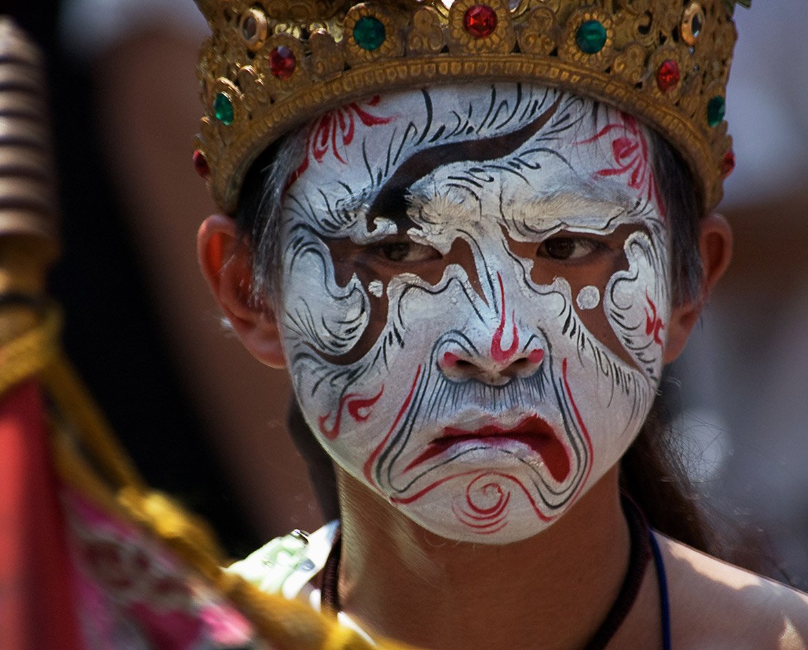
- Knife-Pole Festival | March
- China is forever associated with its ancient civilizations & many of the world’s most revered treasures. Of particular fascination to those visiting Mainland China are its many ethnic minority festivals. Held in the Yunnan province, The Knife-Pole Festival falls on the 8th day of the 2nd Chinese lunar month (usually in March). It is the official festival of the Lisu people, a minority group native to the region. The celebration originates from the Lisu people’s gratitude to a Han hero for teaching them how to make a knife, enabling them to drive away Ming Dynasty conquerors. Activities include diving into a fire sea, where performers jump into a large bonfire. It is believed that in doing so disaster will be averted. The climactic sequence begins when a group of men drink a lot of wine & then immediately begin a barefoot climb up a ladder made from 2 20-meter-high wooden poles with 72 razor sharp knives acting as rungs. When they reach the top, they throw firecrackers at spectators, who enthusiastically applaud.